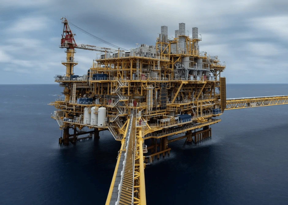
We specialize in providing fast, accurate, and cost-effective 3D laser scanning and modeling services for offshore oil and gas platforms and onshore facilities. Our Faro S150 scanner captures precise as-built conditions, enabling you to streamline modifications, retrofits, and maintenance planning – without the unnecessary costs of total station surveys or Aveva E3 deliverables.
- High-accuracy laser scanning for offshore platforms
- Cost-effective, high-precision 3D laser scanning and modeling
The #TailingTeam Difference
- On-Site Laser Scanning – We capture precise 3D data with our FARO S150 scanners in a fast and non-intrusive manner (typically one or two technicians).
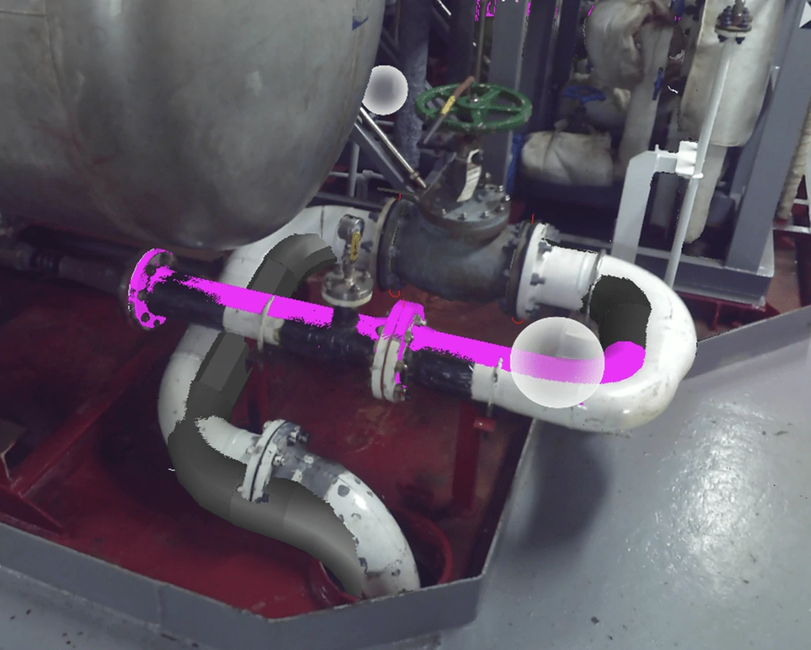
- Point Cloud Processing & Model Generation – We refine the scan date and create highly accurate 3D models tailored for Autodesk tools.
- Seamless Deliverables – We provide point clouds and 3D models ready for Plant 3D, Advance Steel, and Navisworks, ensuring an easy transition into your workflow.
Addressing Accuracy Concerns without Total Station Control
Some may argue that apoint cloud without total station control lacks accuracy, but modern laser scanning technology has significantlyreduced the need for traditional survey networks in smaller offshore environments eliminating the need for multi-person crews.
What Sets Us Apart?
- High Precision Scanning - Our Faro S150 scanner provides accuracy of #1mm at standard offshoredistances, more than sufficient for as-built modeling and retrofit applications.
- Alignment to Known Reference Points - We use existing platform features such as structural beams, pipe racks, and previously verified control points to align scans accurately.
- Cloud-to-Cloud Registration - We employ advanced registration techniques with overlap verification to ensureconsistency and precision across scans.
- Survey Networks are Overkill for Small Platforms - While total stations are necessary for large-scale projects, they introduce unnecessary costs and complexity for smaller 4-to-8 pile platforms, where our approach delivers the required accuracy efficiently.
- Proven Industry Success - Our method has been used successfully in offshore projects, demonstrating there liability of our laser scanning data.
Who Benefits?
- Offshore Operators & Facility Owners - Get precise as-built documentation without costly total station networks.
- Engineering & Design Firms - Receive accurate 3D models ready for integration into your Autodesk-based workflows.
- Maintenance & Retrofit Teams - Plan and execute modifications efficiently with reliable point cloud data and 3D models.
Why Choose Tailing?
- No Total Station Required - Our laser scanning approach eliminates the need for costly and time-consuming total station surveys.
- Autodesk-Ready Deliverables - We provide 3D models and point cloud data compatible with Autodesk Plant 3D, Advance Steel, and Navisworks - saving you conversion costs.
- Minimal Offshore Downtime - Our streamlined scanning process ensures rapid data collection, reducing operational disruptions.
- Cost Savings Without Compromising Accuracy - We deliver high-precision results at a fraction of the cost of traditional survey methods.
- Seamless Integration with Your Workflow - Our data is ready for direct use in engineering and design applications, eliminating unnecessary rework.